
Home


Project Start: 1999
End of Offline Phase: 2010
End of Online Phase: 2026
The MepBay application (Model for Equilibrium Planform of Bay Beaches) is an open-access computational tool designed to assist students and professionals in the earth sciences with morphological analysis of bay beaches and their changes.
It was developed in JAVA to facilitate the application of the model, which utilizes the equation proposed by Hsu & Evans (1989) for the analysis of planform equilibrium of beaches. The user inputs the location of the upcoast promontory, the dowcoast end of the beach, and the predominant wave direction. With this information, the application can calculate the idealized shoreline.
The tool offers a user-friendly interface with easy navigation, providing instant visualization of results. This simplifies the application of the Hsu & Evans (1989) equation for different wave diffraction points. The application not only enhances the user’s understanding of morphological processes but also serves as a valuable tool for analyzing coastal management and protection projects (Figure 1).
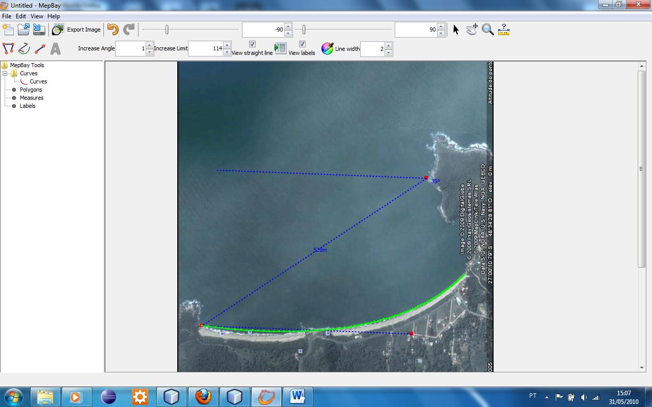 Figure 1: Demonstrative image of a project in the MepBay application. Source: MepBay application.
Financial Support:

Ministries of Culture, Technology, and Innovation
National Fund for Scientific and Technological Development No. 59/2022
Process Number: 406603/2022-7
Modeling of the Global Climate System, Impacts, Vulnerability and Adaptation
to Climate Change and Monitoring and Prediction of Natural Disasters
Project: CASSIE Core – Coastal Analyst System from Space Imagery Engine
Collaborative Research Platform
Institutional Support:


Partners:

Note:
UNIVALI – offline version (developed)
UFSC and Appix – online version (under development)

